Saint-Jean-sur-Richelieu | |
|---|---|
| Ville de Saint-Jean-sur-Richelieu | |
 Downtown Saint Jean sur Richelieu | |
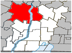
 Location within Le Haut-Richelieu RCM | |
| Coordinates: 45°19′N 73°16′W / 45.317°N 73.267°W[1] | |
| Country | Canada |
| Province | Quebec |
| Region | Montérégie |
| RCM | Le Haut-Richelieu |
| Settled | 1665 |
| Constituted | January 24, 2001 |
| Government | |
| • Mayor | Andrée Bouchard |
| • Federal riding | Saint-Jean |
| • Prov. riding | Iberville and Saint-Jean |
| Area | |
• City | 233.75 km2 (90.25 sq mi) |
| • Land | 226.93 km2 (87.62 sq mi) |
| • Urban | 53.80 km2 (20.77 sq mi) |
| Population (2021)[4] | |
• City | 97,873 |
| • Density | 431.3/km2 (1,117/sq mi) |
| • Urban | 88,083 |
| • Urban density | 1,637.3/km2 (4,241/sq mi) |
| • | |
| • Dwellings | 44,255 |
| Time zone | UTC−5 (EST) |
| • Summer (DST) | UTC−4 (EDT) |
| Postal code(s) | |
| Area code(s) | 450 and 579 |
| Highways | |
| Website | www.ville.saint-jean -sur-richelieu.qc.ca |
Saint-Jean-sur-Richelieu (French pronunciation: [sɛ̃ ʒɑ̃ syʁ ʁiʃ(ə)ljø]) is a city in eastern Montérégie in the Canadian province of Quebec, about 40 kilometres (25 mi) southeast of Montreal, located roughly halfway between Montreal and the Canada–United States border with the state of Vermont. It is situated on both the west and east banks of the Richelieu River at the northernmost navigable point of Lake Champlain. As of December 2019, the population of Saint-Jean-sur-Richelieu was 98,036.[6]
- ^ Cite error: The named reference
toponymiewas invoked but never defined (see the help page). - ^ a b Ministère des Affaires municipales, des Régions et de l'Occupation du territoire: Saint-Jean-sur-Richelieu
- ^ Parliament of Canada Federal Riding History: SAINT-JEAN (Quebec)[permanent dead link]
- ^ a b [1], 2021 Census Municipal Data.
- ^ [2], 2021 Census Population Centre.
- ^ "Portrait de la ville". Ville de Saint-Jean-sur-Richelieu (in French). Retrieved 2020-07-05.


