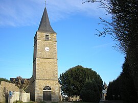
Saint-Sauveur-de-Carrouges | |
|---|---|
 The church in Saint-Sauveur-de-Carrouges | |
| Coordinates: 48°35′12″N 0°06′21″W / 48.5867°N 0.1058°W | |
| Country | France |
| Region | Normandy |
| Department | Orne |
| Arrondissement | Alençon |
| Canton | Magny-le-Désert |
| Government | |
| • Mayor (2020–2026) | Jean-Pierre Trouillot[1] |
| Area 1 | 11.42 km2 (4.41 sq mi) |
| Population (2021)[2] | 243 |
| • Density | 21/km2 (55/sq mi) |
| Time zone | UTC+01:00 (CET) |
| • Summer (DST) | UTC+02:00 (CEST) |
| INSEE/Postal code | 61453 /61320 |
| Elevation | 209–356 m (686–1,168 ft) (avg. 325 m or 1,066 ft) |
| 1 French Land Register data, which excludes lakes, ponds, glaciers > 1 km2 (0.386 sq mi or 247 acres) and river estuaries. | |
Saint-Sauveur-de-Carrouges (French pronunciation: [sɛ̃ sovœʁ də kaʁuʒ] , literally Saint-Saviour of Carrouges) is a commune in the Orne department in north-western France.[3] As of 2021, the commune had a total population of 243 residents.
- ^ "Répertoire national des élus: les maires". data.gouv.fr, Plateforme ouverte des données publiques françaises (in French). 9 August 2021.
- ^ "Populations légales 2021" (in French). The National Institute of Statistics and Economic Studies. 28 December 2023.
- ^ INSEE commune file


