This article needs additional citations for verification. (February 2013) |
Native name: Youloumain (Island Carib) | |
|---|---|
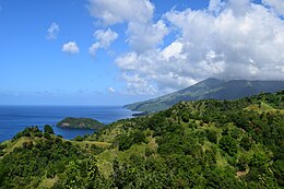
 View of Saint Vincent | |
| Geography | |
| Location | Caribbean Sea on the West Coast Atlantic Ocean on the East Coast. |
| Coordinates | 13°15′N 61°12′W / 13.250°N 61.200°W |
| Archipelago | Windward Islands |
| Area | 345 km2 (133 sq mi) |
| Length | 18 mi (29 km) |
| Width | 11 mi (18 km) |
| Highest point | La Soufrière 4,048 ft (1,234 m) |
| Administration | |
| Parishes | 6 |
| Constituencies | 15 |
| Largest settlement | Kingstown (pop. 25,418) |
| Demographics | |
| Population | 100,000 (2012) |
| Pop. density | 347.83/km2 (900.88/sq mi) |
| Ethnic groups | Black 66%, East Indian 6%, Garifuna 2%, Mixed Race 19%, White 4%, Other 3%. |
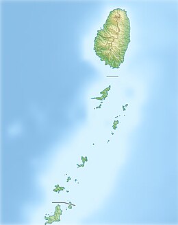
Saint Vincent is a volcanic island in the Caribbean. It is the largest island of the country Saint Vincent and the Grenadines and is located in the Caribbean Sea, between Saint Lucia and Grenada. It is composed of partially submerged volcanic mountains. Its largest volcano and the country's highest peak, La Soufrière, is active,[1] with the latest episode of volcanic activity having begun in December 2020 and intensifying in April 2021.[2]
There were major territory wars between the indigenous population of the Black Caribs, also called the Garifuna, and Great Britain in the 18th century, before the island was ceded to the British in 1763, and again in 1783. Saint Vincent and the Grenadines gained independence from the United Kingdom on 27 October 1979, and became part of the British Commonwealth of Nations thereafter. Approximately 130,000 people currently live on the island, and the population saw significant migration to the UK in the early 1900s, and between the 1940s, and 1980s. There has also been significant migration to Canada, and other larger neighbouring Anglo-Caribbean islands. The main island consists of the capital Kingstown, with the rest of the island divided into, five main coastal strip towns of; Layou, Barrouallie, Chateaubelair, Georgetown, and Calliaqua.
- ^ Rogozinski, Jan (1999). A Brief History of the Caribbean (Revised ed.). New York: Facts on File, Inc. pp. 358–359. ISBN 0-8160-3811-2.
- ^ Hodgson, Martin (8 April 2021). "St Vincent orders evacuations as volcanic eruption appears imminent". The Guardian.


