You can help expand this article with text translated from the corresponding article in French. (February 2009) Click [show] for important translation instructions.
|
Sainte-Catherine | |
|---|---|
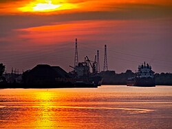
 Saint Lawrence Seaway at Sainte-Catherine | |
 Location within Roussillon RCM | |
| Coordinates: 45°24′14″N 73°34′13″W / 45.40402°N 73.5704°W[1] | |
| Country | |
| Province | |
| Region | Montérégie |
| RCM | Roussillon |
| Constituted | October 30, 1937 |
| Government | |
| • Mayor | Jocelyne Bates |
| • Federal riding | La Prairie |
| • Prov. riding | Sanguinet |
| Area | |
• Total | 16.00 km2 (6.18 sq mi) |
| • Land | 9.50 km2 (3.67 sq mi) |
| Population | |
• Total | 16,762 |
| • Density | 1,764.1/km2 (4,569/sq mi) |
| • Pop 2006–2011 | |
| • Dwellings | 6,652 |
| Time zone | UTC−5 (EST) |
| • Summer (DST) | UTC−4 (EDT) |
| Postal code(s) | |
| Area code(s) | 450 and 579 |
| Highways | |
| Website | www |
Sainte-Catherine (French pronunciation: [sɛ̃t katʁin] ) is an off-island suburb of Montreal, in southwestern Quebec, Canada, on the St. Lawrence River in the Regional County Municipality of Roussillon. The population as of the Canada 2011 Census was 16,762.
- ^ Cite error: The named reference
toponymiewas invoked but never defined (see the help page). - ^ a b Ministère des Affaires municipales, des Régions et de l'Occupation du territoire: Sainte-Catherine
- ^ Riding history for Châteauguay–Saint-Constant, Quebec from the Library of Parliament
- ^ a b Cite error: The named reference
cp2011was invoked but never defined (see the help page).
