Saka | |
|---|---|
Village | |
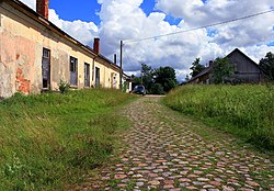
 Old road in Saka. | |
| Coordinates: 56°51′00″N 21°13′00″E / 56.85000°N 21.21667°E | |
| Country | |
| Municipality | Pāvilosta |
| Parish | Saka |
| Elevation | 5 m (16 ft) |
| Population (2020)[1] | |
| • Total | 30 |
| Post code | LV-2142 |
Saka (Latvian: Saka, until 1918 German: Sackenhausen) is a village in Pāvilosta Municipality Latvia, the administrative center of Saka Parish. Located at the confluence of the rivers Durba and Tebra, forming the river Saka. The regional highway P111 (Ventspils — Grobiņa) passes nearby. The distance to the city Liepāja is about 52 km.
According to the data for 2017, 33 people lived in the settlement.[1] [2] There is a Parish administration, a library, a guest house, Lutheran and Baptist churches.
- ^ a b (in Latvian) Database of geographical objects of Latvia
- ^ (in Latvian) "Informācija par objektu: Saka". Database of geographical objects of Latvia. Latvijas Ģeotelpiskās informācijas aģentūra. Retrieved 21 December 2016.
