| Salmon Brook | |
|---|---|
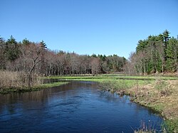
 Salmon Brook in Dunstable, Massachusetts | |
| Location | |
| Country | United States |
| States | Massachusetts, New Hampshire |
| Counties | Middlesex, MA, Hillsborough, NH |
| Communities | Dunstable, MA, Nashua, NH |
| Physical characteristics | |
| Source | Lower Massapoag Pond[1] |
| • location | Groton, MA |
| • coordinates | 42°40′7″N 71°29′39″W / 42.66861°N 71.49417°W |
| • elevation | 154 ft (47 m) |
| Mouth | Merrimack River |
• location | Nashua, NH |
• coordinates | 42°44′55″N 71°26′30″W / 42.74861°N 71.44167°W |
• elevation | 95 ft (29 m) |
| Length | 9.3 mi (15.0 km) |
| Basin size | 36 square miles (93 km2) |
| Discharge | |
| • average | 150 cu ft/s (4.2 m3/s) |
| Basin features | |
| Tributaries | |
| • left | Hauk Brook, Joint Grass Brook, Hassells Brook |
| • right | Black Brook, Old Maids Brook |
Salmon Brook is one of the six major tributaries of the Merrimack River in northeastern Massachusetts in the United States. Its watershed is 31 square miles (80 km2) and is one of the 14 subwatersheds of the Merrimack River. It passes through Dunstable, Massachusetts, and Nashua, New Hampshire.


