Samakh
سمخ Samach | |
|---|---|
 Samakh from the air, 1931 | |
| Etymology: "fish"[1] or "gum"[2] | |
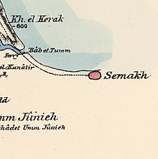
A series of historical maps of the area around Samakh, Tiberias (click the buttons) | |
Location within Mandatory Palestine | |
| Coordinates: 32°42′18″N 35°35′15″E / 32.70500°N 35.58750°E | |
| Palestine grid | 205/234 |
| Geopolitical entity | Mandatory Palestine |
| Subdistrict | Tiberias |
| Date of depopulation | 28 April 1948[5] |
| Area | |
• Total | 9,265 dunams (9.265 km2 or 3.577 sq mi) |
| Population (1945) | |
• Total | 3,460[3][4] |
| Cause(s) of depopulation | Military assault by Yishuv forces |
| Current Localities | Ma'agan[6][7] Tel Katzir[7] Masada,[7] Sha'ar HaGolan[7] |


Samakh (Arabic: سمخ) was a Palestinian Arab village at the south end of Lake Tiberias (the Sea of Galilee) in Ottoman Galilee and later Mandatory Palestine (now in Israel). It was the site of battle in 1918 during World War I.
In the 19th century, Algerian migrants settled in Samakh, transforming it into one of the largest Algerian concentrations in the district.[8] Between 1905 and 1948, the town was an important stop on the Jezreel Valley railway and Hejaz railway, being the last effective stop in the British Mandate of Palestine (the station at al-Hamma was geographically isolated). It had a population of 3,320 Arab Muslims and Arab Christians in 1945.[9]
The town's inhabitants fled after Haganah forces captured the town on 3 March 1948, and the remainder left in the wake of an assault by the Golani Brigade against the Syrian army on 18 April 1948. Most of the former residents became internally displaced refugees in the Arab city of Nazareth.[10] Today, the Tzemah Industrial Zone and part of kibbutz Ma'agan are on the site of the former village.
- ^ Irby and Mangles, 1823, p. 296
- ^ Palmer, 1881, pp. 50, 133
- ^ Department of Statistics, 1945, p. 12
- ^ a b Government of Palestine, Department of Statistics. Village Statistics, April, 1945. Quoted in Hadawi, 1970, p. 72
- ^ Morris, 2004, p. xvii, village# 103. Also gives the cause of depopulation.
- ^ Morris, 2004, p. xxii, settlement # 144
- ^ a b c d Cite error: The named reference
khalidi538was invoked but never defined (see the help page). - ^ Ahmad Abbasi, Mustafa (2007). "הקהילה האלג'יראית בגליל משלהי השלטון העות'מני עד שנת 1948". אופקים בגיאוגרפיה. 68/9: 56–62.
- ^ Appendix B - Non-Jewish Population within the Boundaries Held by the Israel Defence Army on 1.5.49 - as on 1.4.45, in accordance with Government of Palestine, Village Statistics, April, 1945, p. 7 Archived 2012-06-09 at the Wayback Machine
- ^ "Welcome to Samakh". Palestine Remembered. Retrieved 2007-12-04.


