| Sammamish River Sammamish Slough, Squak Slough | |
|---|---|
 | |
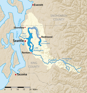
 Map of the Lake Washington drainage basin with the Sammamish River highlighted | |
| Location | |
| Country | United States of America |
| State | Washington |
| County | King |
| Physical characteristics | |
| Source | Lake Sammamish |
| • location | Washington, United States of America |
| • coordinates | 47°39′09″N 122°06′24″W / 47.65250°N 122.10667°W |
| • elevation | 30 ft (9.1 m) |
| Mouth | Lake Washington |
• location | Washington, United States of America |
• coordinates | 47°45′12″N 122°15′30″W / 47.75333°N 122.25833°W |
• elevation | 16 ft (4.9 m) |
| Length | 14 mi (23 km) |
| Discharge | |
| • location | USGS gage 12125200 near Woodinville, Washington[1] |
| • average | 304 cu ft/s (8.6 m3/s)[1] |
| • minimum | 25 cu ft/s (0.71 m3/s) |
| • maximum | 2,830 cu ft/s (80 m3/s) |
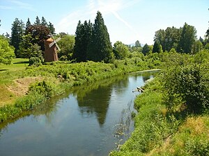
The Sammamish River (also known as Sammamish Slough) flows through north King County, Washington for about 14 miles (23 km), draining Lake Sammamish into Lake Washington. Along its course, the Sammamish River flows through Redmond, Woodinville, Bothell, and Kenmore.
The river is named after the native people who once lived along its entire length.
- ^ a b "Water Resources Data-Washington Water Year 2005; Lake Washington Basins" (PDF). USGS. Retrieved 3 August 2009.