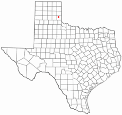
Samnorwood, Texas | |
|---|---|
 Location of Samnorwood, Texas | |
 | |
| Coordinates: 35°03′00″N 100°16′53″W / 35.05000°N 100.28139°W | |
| Country | United States |
| State | Texas |
| County | Collingsworth |
| Area | |
| • Total | 1.6 sq mi (4.2 km2) |
| • Land | 1.6 sq mi (4.2 km2) |
| • Water | 0.0 sq mi (0.0 km2) |
| Elevation | 2,195 ft (669 m) |
| Population (2020) | |
| • Total | 24 |
| • Density | 15/sq mi (5.7/km2) |
| Time zone | UTC-6 (Central (CST)) |
| • Summer (DST) | UTC-5 (CDT) |
| ZIP code | 79077 |
| Area code | 806 |
| FIPS code | 48-64448[2] |
| GNIS feature ID | 2409245[1] |
Samnorwood is a census-designated place (CDP) in Collingsworth County, Texas, United States. It was designated in or after 1980. The population was 24 at the 2020 census, down from 51 at the 2010 census.[3] The hamlet of Samnorwood, for which the CDP was named, is located within the CDP.
- ^ a b U.S. Geological Survey Geographic Names Information System: Samnorwood, Texas
- ^ "U.S. Census website". United States Census Bureau. Retrieved January 31, 2008.
- ^ "Geographic Identifiers: 2010 Census Summary File 1 (G001): Samnorwood CDP, Texas". U.S. Census Bureau, American Factfinder. Archived from the original on February 13, 2020. Retrieved August 4, 2015.