Samut Sakhon
สมุทรสาคร | |
|---|---|
| Other transcription(s) | |
| • Teochew | 龍仔厝 lê̬ng giăn cu (Peng'im) |
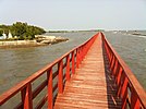
(Clockwise from top left) Phan Thai Norasing Shrine; Salt farming in Samut Sakhon; Mahachai seafood market; Ban Laem railway station, the origin of Maeklong Railway (second phase); Mahachai–Tha Chalom ferry; Red Bridge | |
| Nickname: Mahachai (Thai: มหาชัย) | |
| Motto: เมืองประมง ดงโรงงาน ลานเกษตร เขตประวัติศาสตร์ ("City of fisheries. District of factories. Fields of farming. Historical area.") | |
 Map of Thailand highlighting Samut Sakhon province | |
| Country | Thailand |
| Capital | Mueang Samut Sakhon |
| Government | |
| • Governor | Narong Rakroi (since September 2021) |
| Area | |
| • Total | 872 km2 (337 sq mi) |
| • Rank | Ranked 73rd |
| Population (2019)[2] | |
| • Total | 584,703 |
| • Rank | Ranked 44th |
| • Density | 662/km2 (1,710/sq mi) |
| • Rank | Ranked 6th |
| Human Achievement Index | |
| • HAI (2022) | 0.6101 "low" Ranked 74th |
| GDP | |
| • Total | baht 398 billion (US$13.1 billion) (2019) |
| Time zone | UTC+7 (ICT) |
| Postal code | 74xxx |
| Calling code | 034 |
| ISO 3166 code | TH-74 |
| Website | www |
Samut Sakhon (Thai: สมุทรสาคร, pronounced [sā.mùt sǎː.kʰɔ̄ːn]) is one of the central provinces (changwat) of Thailand, located along the coast of the Gulf of Thailand. In 2019, it had a population of 584,703,[5] and an area of 872 km²,[6] making it the 33rd most populated province whilst being the 4th smallest. Neighboring provinces are (from the southwest clockwise) Samut Songkhram, Ratchaburi, Nakhon Pathom, and Bangkok. Samut Sakhon is part of the Bangkok Metropolitan Region.
- ^ Advancing Human Development through the ASEAN Community, Thailand Human Development Report 2014, table 0:Basic Data (PDF) (Report). United Nations Development Programme (UNDP) Thailand. pp. 134–135. ISBN 978-974-680-368-7. Retrieved 17 January 2016, Data has been supplied by Land Development Department, Ministry of Agriculture and Cooperatives, at Wayback Machine.
{{cite report}}: CS1 maint: postscript (link)[dead link] - ^ "สถิติทางการทะเบียน" [Registration statistics]. bora.dopa.go.th. Department of Provincial Administration (DOPA). December 2019. Retrieved 22 September 2020.
Download จำนวนประชากร ปี พ.ศ.2562 - Download population year 2019
- ^ "ข้อมูลสถิติดัชนีความก้าวหน้าของคน ปี 2565 (PDF)" [Human Achievement Index Databook year 2022 (PDF)]. Office of the National Economic and Social Development Council (NESDC) (in Thai). Retrieved 12 March 2024, page 75
{{cite web}}: CS1 maint: postscript (link) - ^ "Gross Regional and Provincial Product, 2019 Edition". <>. Office of the National Economic and Social Development Council (NESDC). July 2019. ISSN 1686-0799. Retrieved 22 January 2020.
- ^ Cite error: The named reference
:0was invoked but never defined (see the help page). - ^ Cite error: The named reference
:1was invoked but never defined (see the help page).


