San Fernando, California | |
|---|---|
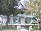
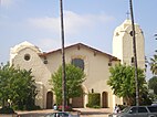
Santa Rosa Church Saint Ferdinand Catholic Church | |
| Coordinates: 34°17′14″N 118°26′20″W / 34.28722°N 118.43889°W | |
| Country | |
| State | |
| County | Los Angeles |
| Incorporated | August 31, 1911[1] |
| Named for | St. Ferdinand |
| Government | |
| • Type | Council-Manager |
| • Mayor | Celeste T. Rodriguez |
| • Vice Mayor | Mary Mendoza |
| • City council[2] | Joel Fajardo Cindy Montañez Mary Solorio |
| Area | |
• Total | 2.37 sq mi (6.15 km2) |
| • Land | 2.37 sq mi (6.15 km2) |
| • Water | 0.00 sq mi (0.00 km2) 0% |
| Elevation | 1,070 ft (326 m) |
| Population (2020) | |
• Total | 23,946 |
• Estimate (2022)[5] | 23,685 |
| • Density | 10,086.80/sq mi (26,124.69/km2) |
| Time zone | UTC-8 (PST) |
| • Summer (DST) | UTC-7 (PDT) |
| ZIP Code | 91340-91342, 91344-91346[6] |
| Area code(s) | 818, 747[7] |
| FIPS code | 06-66140 |
| GNIS feature IDs | 1652786, 2411785 |
| Website | www |
San Fernando (Spanish for "St. Ferdinand") is a general-law city[8] in the San Fernando Valley region of Los Angeles County, California, in the Los Angeles metropolitan area. It is an enclave in the City of Los Angeles. As of the 2020 census the population of San Fernando was 23,946.[5]
- ^ "California Cities by Incorporation Date". California Association of Local Agency Formation Commissions. Archived from the original (Word) on November 3, 2014. Retrieved August 25, 2014.
- ^ "City Council". City of San Fernando.
- ^ "2019 U.S. Gazetteer Files". United States Census Bureau. Retrieved July 1, 2020.
- ^ "San Fernando". Geographic Names Information System. United States Geological Survey, United States Department of the Interior. Retrieved October 13, 2014.
- ^ a b "QuickFacts". United States Census Bureau. July 1, 2022. Retrieved July 18, 2023.
- ^ "USPS - ZIP Code Lookup - Find a ZIP+ 4 Code By City Results". Retrieved January 18, 2007.
- ^ "Number Administration System - NPA and City/Town Search Results". Archived from the original on November 4, 2009. Retrieved January 18, 2007.
- ^ "Elections". City of San Fernando. Archived from the original on November 30, 2021 – via The Wayback Machine, The Internet Archive.


