San Fernando de Henares | |
|---|---|
 Town hall | |
| Coordinates: 40°25′32″N 3°32′7″W / 40.42556°N 3.53528°W | |
| Country | |
| Region | |
| Comarca | Madrid metropolitan area |
| Founded | 1746 |
| Government | |
| • Alcalde | Cati Rodriguez (2015) (San Fernando de Henares sí puede (SFHSP)) |
| Area | |
• Total | 39.29 km2 (15.17 sq mi) |
| Elevation | 580 m (1,900 ft) |
| Population (2018)[1] | |
• Total | 39,466 |
| • Density | 1,000/km2 (2,600/sq mi) |
| Demonym | Sanfernandinos |
| Time zone | UTC+1 (CET) |
| • Summer (DST) | UTC+2 (CEST) |
| Postal code | 28830 |
| Dialing code | 91 |
| Website | Official website |
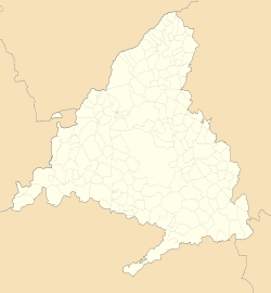
San Fernando de Henares is a municipality in Spain, in the province and autonomous community of Madrid. It has an area of 39.9 km2 and 38,904 inhabitants (2022[2]). Its agricultural production includes olives, cereals, vegetables, cattle and wool. Its industries include metalworking, mechanical engineering,[3] food processing and graphic arts.
- ^ Municipal Register of Spain 2018. National Statistics Institute.
- ^ "Madrid: Población por municipios y sexo. (2881)". INE (in Spanish). Retrieved 2023-10-11.
- ^ Lee, Andrew (16 March 2020). "Wind giant Siemens Gamesa closes plant after coronavirus case". Recharge | Latest renewable energy news.


