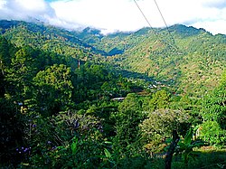
San Juancito | |
|---|---|
| Nickname: San Juancito de las Minas | |
 | |
| Coordinates: 14°13′12″N 87°04′06″W / 14.219958°N 87.068367°W | |
| Country | Honduras |
| Department | Francisco Morazán |
| Municipality | Distrito Central |
| Founded | 16th century |
| Government | |
| • Type | Democratic municipality |
| • Mayor | Nasry Asfura (PNH) |
| Area | |
| • City | 5 km2 (2 sq mi) |
| Elevation | 1,239 m (4,027 ft) |
| Population (2009) | |
| • City | 900 |
| • Metro | 1,400 |
| Time zone | UTC-6 (Central) |
| Website | www |
San Juancito is a small town in central Honduras, located 40 km northeast of Tegucigalpa, the nation's capital. The town is in the department of Francisco Morazán. Including the dependent hamlets of Nuevo Rosario, Guacamaya, and Plan Grande, the population totals at about 1400. Its central neighborhood is depicted on the back of the 500-lempira bill.
While its history is linked to mining, its current importance lies in that it is located within the buffer zone of La Tigra National Park, a cloud forest ecosystem and Honduras' first national park. The park is a huge watershed, providing water for over a half million people in the capital; San Juancito is located on the northern side of the La Tigra, and has had paved access since 2003. It is the lesser-visited of the park's two entrances (the other being at Jutiapa, on the southwestern side of the park).
