San Martin | |
|---|---|
|
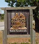
Clockwise: Sign on Monterey Road; Lion's Peak; Old San Martin Winery. | |
 Location in Santa Clara County and the state of California | |
| Coordinates: 37°5′16″N 121°36′0″W / 37.08778°N 121.60000°W | |
| Country | United States |
| State | California |
| County | Santa Clara |
| Named for | St. Martin of Tours |
| Government | |
| • Mayor | Michael Moore[1] |
| Area | |
• Total | 11.596 sq mi (30.035 km2) |
| • Land | 11.596 sq mi (30.035 km2) |
| • Water | 0 sq mi (0 km2) 0% |
| Elevation | 289 ft (88 m) |
| Population (2010) | |
• Total | 7,027 |
| • Density | 610/sq mi (230/km2) |
| Time zone | UTC-8 (Pacific) |
| • Summer (DST) | UTC-7 (PDT) |
| ZIP code | 95046 |
| Area code | 408/669 |
| FIPS code | 06-68238 |
| GNIS feature ID | 277595 |
San Martin or San Martín (Spanish for Saint Martin) is a village and census-designated place (CDP) in Santa Clara County, California, in the southern Santa Clara Valley. Located to the south of Morgan Hill and north of Gilroy, San Martin is characterized by ranches, wineries, and orchards, as well as large estates in the foothills of the Santa Cruz Mountains.
- ^ "Michael Moore - Morgan Hill Times". www.morganhillimes.com.
- ^ "2010 Census U.S. Gazetteer Files – Places – California". United States Census Bureau.


