This article includes a list of general references, but it lacks sufficient corresponding inline citations. (August 2015) |
| San Pablo Bay National Wildlife Refuge | |
|---|---|
IUCN category IV (habitat/species management area) | |
 | |
Map of the United States | |
| Location | Napa County, Solano County, Sonoma County, California, United States |
| Nearest city | Vallejo, California |
| Coordinates | 38°08′30″N 122°24′04″W / 38.1415854°N 122.4010866°W[1] |
| Area | 13,190 acres (53.4 km2) |
| Established | 1970 |
| Governing body | U.S. Fish and Wildlife Service |
| Website | San Pablo Bay National Wildlife Refuge |
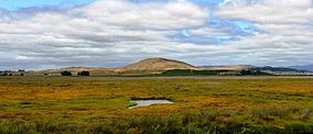
San Pablo Bay National Wildlife Refuge is a 13,190-acre (53.4 km2) National Wildlife Refuge in California established in 1970. It extends along the northern shore of San Pablo Bay, from the mouth of the Petaluma River, to Tolay Creek, Sonoma Creek, and ending at Mare Island.

