San Ramon, California | |
|---|---|
 San Ramon Waterfall Park | |
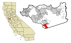
 Location in Contra Costa County and the state of California | |
| Coordinates: 37°46′48″N 121°58′41″W / 37.78000°N 121.97806°W | |
| Country | United States |
| State | California |
| County | Contra Costa |
| Incorporated | July 1, 1983[1] |
| Government | |
| • Mayor | Dave Hudson[2] |
| • State senator | Steve Glazer (D)[3] |
| • Assemblymember | Rebecca Bauer-Kahan (D)[4] |
| • United States representatives[6] | Mark DeSaulnier (D)[5] |
| Area | |
• Total | 18.72 sq mi (48.48 km2) |
| • Land | 18.68 sq mi (48.39 km2) |
| • Water | 0.03 sq mi (0.09 km2) 0.09% |
| Elevation | 486 ft (148 m) |
| Population | |
• Total | 84,605 |
| • Rank | 96th in California |
| • Density | 4,500/sq mi (1,700/km2) |
| Time zone | UTC−8 (Pacific) |
| • Summer (DST) | UTC−7 (PDT) |
| ZIP Codes[10] | 94582–94583 |
| Area code | 925 |
| FIPS code | 06-68378 |
| GNIS feature IDs | 1656275, 2411805 |
| Website | www |
San Ramon (Spanish: San Ramón, meaning "Saint Raymond") is a city in Contra Costa County, California, United States, located within the San Ramon Valley, and 34 miles (55 km) east of San Francisco. San Ramon's population was 84,605 per the 2020 census,[9] making it the 4th largest city in Contra Costa County, behind Concord, Richmond and Antioch.
San Ramon is home to the headquarters of Chevron Corporation, Cooper Companies, the West Coast headquarters of AT&T, GE Digital, as well as the San Ramon Medical Center. Major annual events include the Art and Wind Festival on Memorial Day weekend and the Run for Education in October.
- ^ "California Cities by Incorporation Date". California Association of Local Agency Formation Commissions. Archived from the original (Word) on November 3, 2014. Retrieved March 27, 2013.
- ^ "City Council". City of San Ramon. Retrieved March 29, 2021.
- ^ "Senators". State of California. Retrieved March 27, 2013.
- ^ "Members Assembly". State of California. Retrieved March 27, 2013.
- ^ "California's 10th Congressional District - Representatives & District Map". Civic Impulse, LLC. Retrieved April 25, 2023.
- ^ "Communities of Interest – City". California Citizens Redistricting Commission. Archived from the original on September 30, 2013. Retrieved September 27, 2014.
- ^ "2019 U.S. Gazetteer Files". United States Census Bureau. Retrieved July 1, 2020.
- ^ "San Ramon". Geographic Names Information System. United States Geological Survey, United States Department of the Interior. Retrieved November 3, 2014.
- ^ a b "San Ramon (city) QuickFacts". United States Census Bureau.
- ^ "ZIP Code(tm) Lookup". United States Postal Service. Retrieved November 23, 2014.
- ^ "Population and Housing Unit Estimates". Retrieved May 21, 2020.


