| San Salvador Volcano | |
|---|---|
 The San Salvador volcano is instantly recognizable by its distinctive triangular crescent pointed apex, which has a dorsal fin-like shape. | |
| Highest point | |
| Elevation | 1,893 m (6,211 ft) |
| Prominence | 1,580 m (5,180 ft) |
| Parent peak | Cerro El Picacho |
| Isolation | 4.08 km (2.54 mi) |
| Coordinates | 13°44′02″N 89°17′38″W / 13.734°N 89.294°W |
| Naming | |
| Nickname | Quezaltepeque |
| Geography | |
| Country | |
| Departments | . |
| Geology | |
| Rock age | Pleistocene |
| Mountain type | Complex |
| Rock type | Basalt and Andesite |
| Volcanic arc | Central America |
| Last eruption | 7 June 1917 |
| Climbing | |
| Normal route | Drive and hike via El Boquerón Highway |
| Access | El Boquerón National Park |
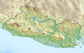
The San Salvador Volcano (also known as Quezaltepeque or El Boquerón) is a stratovolcano situated northwest to the city of San Salvador. The crater has been nearly filled with a relatively newer edifice, the Boquerón volcano. San Salvador is adjacent to the volcano and the western section of the city actually lies among its slopes. Due to this close proximity, any geological activity of the volcano, whether eruptive or not, has the potential to result in catastrophic destruction and death to the city. Despite this, the volcano is iconic of the city, and several TV and radio antennas are situated on the El Picacho peaks and the crater of Boqueron. El Picacho, the prominent peak is the highest elevation (1,960 meters altitude).
