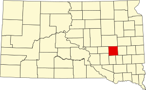
Sanborn County | |
|---|---|
 Steam-powered automobile by E.S. Callihan in Woonsocket (1884) | |
 Location within the U.S. state of South Dakota | |
 South Dakota's location within the U.S. | |
| Coordinates: 44°02′N 98°05′W / 44.03°N 98.09°W | |
| Country | |
| State | |
| Founded | 1883 |
| Named for | George W. Sanborn |
| Seat | Woonsocket |
| Largest city | Woonsocket |
| Area | |
| • Total | 570 sq mi (1,500 km2) |
| • Land | 569 sq mi (1,470 km2) |
| • Water | 1.2 sq mi (3 km2) 0.2% |
| Population (2020) | |
| • Total | 2,330 |
| • Estimate (2023) | 2,399 |
| • Density | 4.1/sq mi (1.6/km2) |
| Time zone | UTC−6 (Central) |
| • Summer (DST) | UTC−5 (CDT) |
| Congressional district | At-large |
Sanborn County is a county in the U.S. state of South Dakota. As of the 2020 census, the population was 2,330.[1] Its county seat and largest city is Woonsocket.[2] The county was created by the Dakota Territorial legislature on May 1, 1883, with land partitioned from Miner County. It was fully organized by July 18, 1883.[3]
- ^ "State & County QuickFacts". United States Census Bureau. Retrieved March 20, 2024.
- ^ "Find a County". National Association of Counties. Retrieved June 7, 2011.
- ^ History of SD Counties/Sanborn (accessed February 8, 2019)