| Sandia Mountains | |
|---|---|
 The Sandia Mountains and Rio Grande at sunset, looking southeast from Bernalillo | |
| Highest point | |
| Peak | Sandia Crest |
| Elevation | 10,678 ft (3,255 m) |
| Prominence | 4,201 ft (1,280 m) (crest) |
| Coordinates | 35°12′32″N 106°26′49″W / 35.20889°N 106.44694°W |
| Dimensions | |
| Length | 17 mi (27 km) N-S |
| Width | 8 mi (13 km) E-W |
| Naming | |
| Language of name | Dził Nááyisí (Navajo) |
| Geography | |
| Country | United States |
| State | New Mexico |
| Parent range | Sandia–Manzano Mountains |
| Borders on | Albuquerque, NM |
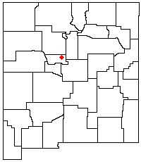
The Sandia Mountains (Southern Tiwa: Posu gai hoo-oo, Keres: Tsepe, Navajo: Dził Nááyisí; Tewa: O:ku:p’į, Northern Tiwa: Kep’íanenemą; Towa: Kiutawe, Zuni: Chibiya Yalanne)[1] are a mountain range located in Bernalillo and Sandoval counties, immediately to the east of the city of Albuquerque in New Mexico in the southwestern United States. The mountains are just due south of the southern terminus of the Rocky Mountains, and are part of the Sandia–Manzano Mountains. This is largely within the Cibola National Forest and protected as the Sandia Mountain Wilderness. The highest point is Sandia Crest, 10,678 feet (3,255 m).
- ^ Harrington, J. P. (1920-10-12). "Old Indian Geographical Names Around Santa Fe, New Mexico". American Anthropologist. 22 (4): 341–359. doi:10.1525/aa.1920.22.4.02a00050. hdl:2027/uc2.ark:/13960/t14m91k6v. ISSN 0002-7294.
