Sanford Seacoast Regional Airport | |||||||||||||||
|---|---|---|---|---|---|---|---|---|---|---|---|---|---|---|---|
| Summary | |||||||||||||||
| Airport type | Public | ||||||||||||||
| Owner | City of Sanford | ||||||||||||||
| Location | Sanford, Maine | ||||||||||||||
| Elevation AMSL | 244 ft / 74 m | ||||||||||||||
| Coordinates | 43°23′38″N 070°42′29″W / 43.39389°N 70.70806°W | ||||||||||||||
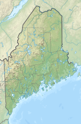
| Map | |||||||||||||||
 | |||||||||||||||
| Runways | |||||||||||||||
| |||||||||||||||
| Statistics (2019) | |||||||||||||||
| |||||||||||||||
Sanford Seacoast Regional Airport (IATA: SFM, ICAO: KSFM, FAA LID: SFM) is a public airport located four miles (6 km) southeast of the central business district of Sanford, a city in York County, Maine, United States. The airport operated as Naval Auxiliary Air Facility Sanford (NAAF Sanford, not to be confused with Naval Air Station Sanford, Florida) supporting operations of Naval Air Station Brunswick from 15 April 1943 until 1 February 1946.[2] This airport is now publicly owned by the City of Sanford.[1]
- ^ a b FAA Airport Form 5010 for SFM PDF, retrieved 7 September 2023
- ^ "Patrol Squadron Shore Establishments" (PDF). United States Navy. Retrieved 7 March 2012.

