| Sangay National Park | |
|---|---|
| Parque nacional Sangay | |
 Sangay National Park | |
| Location | Ecuador |
| Coordinates | 1°50′S 78°20′W / 1.833°S 78.333°W |
| Area | 5,177.65 km2 (1,999.10 sq mi) |
| Established | 1979 |
| Type | Natural |
| Criteria | vii, viii, ix, x |
| Designated | 1983 (7th session) |
| Reference no. | 260 |
| Region | Latin America and the Caribbean |
| Endangered | 1992–2005 |
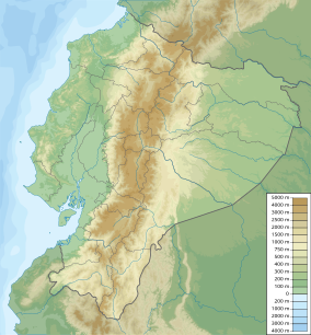
Sangay National Park (Spanish: Parque Nacional Sangay) is a national park located in the Morona-Santiago, Chimborazo, Tungurahua, Cañar, and Azuay provinces of Ecuador. The park contains two active volcanoes (Tungurahua and Sangay), one extinct volcano El Altar (Kapak Urku). Protecting a range of elevations from 900 to 5,319 meters (2,953 to 17,451 ft) above sea level, Sangay National Park contains a wide variety of habitats, including glaciers, volcanic landscapes, tropical rainforests, cloud forests, wetlands, grasslands, and one of the largest regions of páramo (high elevation moorlands) in Ecuador.[1] 327 lakes feed into a vast wetland system covering 31.5 square kilometers (12.2 sq mi).[1]
Because of its complex ecology and geology, as well as its outstanding biodiversity, the park has been listed as a UNESCO World Heritage Site since 1983.[1] In 1992, it was added to the List of World Heritage in Danger due to illegal poaching, extensive grazing, unplanned road construction, and encroachment of the park's perimeter. It was removed from the UNESCO list of endangered sites in 2005.
- ^ a b c "Sangay National Park". UNESCO World Heritage Centre. United Nations Educational, Scientific, and Cultural Organization. Retrieved 5 September 2021.
