You can help expand this article with text translated from the corresponding article in Indonesian. (February 2024) Click [show] for important translation instructions.
|
Sangkulirang | |
|---|---|
 | |
| Coordinates: 0°59′16″N 117°58′48″E / 0.98778°N 117.98000°E | |
| Country | |
| Province | East Kalimantan |
| Regency | East Kutai Regency |
| Government | |
| • Camat | Hormansyah |
| Area | |
| • Total | 3,292.26 km2 (1,271.15 sq mi) |
| Population (2021)[1] | |
| • Total | 26,449 |
| • Density | 8.0/km2 (21/sq mi) |
| Time zone | UTC+8 (ICT) |
| Villages | 15 |
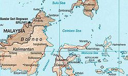
Sangkulirang is a district of East Kutai Regency, East Kalimantan, Indonesia. The district lies in the northern part of the Makassar Strait and at the southern part of the Mangkalihat Peninsula. Sangkulirang is situated in the delta of the Karangan river, which forms the Sangkulirang bay on the east coast of Borneo. Most of the district is vegetated with mangrove forest and has some notable karst areas with steep limestone cliffs.[2] The district's seat is located at Benua Baru Ilir.[1]

