| Sangli State | |||||||||
|---|---|---|---|---|---|---|---|---|---|
| State Within the Maratha Confederacy (1782 - 1818) Princely State of British India | |||||||||
| 1782–1948 | |||||||||
|
Flag | |||||||||
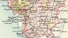
 Sangli State in the Imperial Gazetteer of India | |||||||||
| Area | |||||||||
• 1901 | 2,880 km2 (1,110 sq mi) | ||||||||
| Population | |||||||||
• 1901 | 137,268 | ||||||||
| History | |||||||||
• Established | 1782 | ||||||||
| 1948 | |||||||||
| |||||||||
| Today part of | Maharashtra, India | ||||||||

Sangli State was one of the 11-gun salute Maratha princely states of British India. It was under the Kolhapur-Deccan Residency in the Bombay Presidency, and later the Deccan States Agency.
The Principality of Sangli covered an area of 2,880 square kilometers and had a population of 226,128 in 1901, while the population of the town itself was 16,829 in that year.
The capital of the state was Sangli.[1] The city derives its name from "Saha Galli" ("Six Lanes" in Marathi).
- ^ "Sangli | India". britannica.com.
