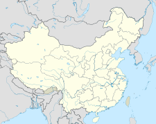
Sanmenxia
三门峡市 Sanmenhsia | |
|---|---|
 | |
 Location of Sanmenxia City jurisdiction in Henan | |
| Coordinates (Sanmenxia government): 34°46′24″N 111°12′01″E / 34.7732°N 111.2004°E | |
| Country | People's Republic of China |
| Province | Henan |
| Municipal seat | Hubin District |
| Area | |
| • Prefecture-level city | 10,475 km2 (4,044 sq mi) |
| • Urban | 1,814.3 km2 (700.5 sq mi) |
| • Metro | 2,995.3 km2 (1,156.5 sq mi) |
| Elevation | 376 m (1,234 ft) |
| Population (2020 census)[1] | |
| • Prefecture-level city | 2,034,872 |
| • Density | 190/km2 (500/sq mi) |
| • Urban | 615,220 |
| • Urban density | 340/km2 (880/sq mi) |
| • Metro | 820,300 |
| • Metro density | 270/km2 (710/sq mi) |
| GDP[2][3] | |
| • Prefecture-level city | CN¥ 132.6 billion US$ 20.0 billion |
| • Per capita | CN¥ 58,894 US$ 8,867 |
| Time zone | UTC+8 (China Standard) |
| Postal Code | 472000 |
| Area code | (0)398 |
| ISO 3166 code | CN-HA-12 |
| Major Ethnicities | Han |
| County-level divisions | 6 |
| License plate prefixes | 豫M |
| Website | smx |
Sanmenxia (simplified Chinese: 三门峡; traditional Chinese: 三門峽; pinyin: Sānménxiá; postal: Sanmenhsia) is a prefecture-level city in the west of Henan Province, China. The westernmost prefecture-level city in Henan, Sanmenxia borders Luoyang to the east, Nanyang to the southeast, Shaanxi Province to the west and Shanxi Province to the north. The city lies on the south side of the Yellow River at the point where the river cuts through the Loess Plateau on its way to the North China Plain.
As of the 2020 census, it was home to 2,034,872 inhabitants of which 820,300 lived in the built-up area made of Hubin, Shanzhou urban districts and Pinglu County in neighboring Shanxi (205,080 inhabitants), now within the agglomeration.
- ^ "China: Hénán (Prefectures, Cities, Districts and Counties) - Population Statistics, Charts and Map".
- ^ 河南省统计局、国家统计局河南调查总队 (November 2017). 《河南统计年鉴-2017》. 中国统计出版社. ISBN 978-7-5037-8268-8. Archived from the original on 2018-11-15. Retrieved 2018-12-03.
- ^ "河南统计年鉴—2017". www.ha.stats.gov.cn. Archived from the original on 2018-11-15. Retrieved 2018-12-03.
