This article needs additional citations for verification. (February 2021) |
| Sans Bois Mountains | |
|---|---|
| Highest point | |
| Peak | Blue Mountain (Oklahoma) |
| Elevation | 1,831 ft (558 m) |
| Coordinates | 35°01′55″N 95°10′06″W / 35.031959°N 95.168324°W |
| Dimensions | |
| Length | 45 mi (72 km) E/W |
| Width | 19 mi (31 km) N/S |
| Area | 505 sq mi (1,310 km2) |
| Geography | |
| Country | United States |
| State | Oklahoma |
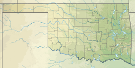
The Sans Bois Mountains are a small mountain range in southeastern Oklahoma and part of the larger Ouachita Mountains. The range is a frontal belt[definition needed] of the Ouachita Mountains and is located in Haskell and Latimer counties. Sans bois is a French term meaning 'without forest' or without wood' in English.[1][2][3][4]
- ^ "Sans Bois Mountains". Peakbagger.com. Retrieved January 13, 2013.
- ^ "San Bois Mountains". Encyclopedia of Oklahoma History and Culture.
- ^ "Sans Bois Mountains". Geographic Names Information System. United States Geological Survey, United States Department of the Interior. Retrieved December 15, 2012.
- ^ Wright, Muriel H. "Some Geographic Names of French Origin in Oklahoma." Chronicles of Oklahoma Volume7, Number 2. June, 1929. Accessed March 28, 2016.
