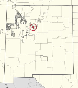
 Location of Santa Ana Pueblo | |
| Total population | |
|---|---|
| 800 | |
| Regions with significant populations | |
| Languages | |
| Keres, English, Spanish |
Santa Ana Pueblo, New Mexico | |
|---|---|
 Pueblo of Santa Ana | |
 Location of Santa Ana Pueblo, New Mexico | |
| Coordinates: 35°20′44″N 106°31′24″W / 35.34556°N 106.52333°W | |
| Country | United States |
| State | New Mexico |
| County | Sandoval |
| Area | |
• Total | 7.54 sq mi (19.52 km2) |
| • Land | 7.40 sq mi (19.15 km2) |
| • Water | 0.14 sq mi (0.36 km2) |
| Elevation | 5,249 ft (1,600 m) |
| Population | |
• Total | 673 |
| • Density | 91.00/sq mi (35.13/km2) |
| Time zone | UTC-7 (Mountain (MST)) |
| • Summer (DST) | UTC-6 (MDT) |
| ZIP code | 87004 |
| Area code | 505 |
| FIPS code | 35-70250 |
| GNIS feature ID | 0928811 |
| Website | santaana-nsn |
Santa Ana Pueblo (Eastern Keres: Tamaya [tʰɑmɑjːɑ]) is a settlement in Sandoval County, New Mexico, United States, of Native Americans who speak an eastern dialect of the Keresan languages. For statistical purposes, the United States Census Bureau has defined this community as a census-designated place (CDP). As of the 2000 census, the CDP had a total population of 479. It is part of the Albuquerque Metropolitan Statistical Area. The Pueblo, named Tamaya in Keres, administers a total reservation land of 73,000 acres (295 km2) in the Rio Grande valley.
The pueblo celebrates an annual feast day for its patron saint, St. Anne, on July 26.[not verified in body]
- ^ "ArcGIS REST Services Directory". United States Census Bureau. Retrieved October 12, 2022.
- ^ Cite error: The named reference
USCensusDecennial2020CenPopScriptOnlywas invoked but never defined (see the help page).
