Native name: Mahaga | |
|---|---|
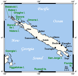
 Map of Santa Isabel, neighbouring islands, and towns and villages | |
 | |
| Geography | |
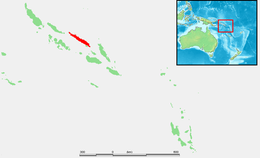
| Location | Pacific Ocean |
| Archipelago | Solomon Islands archipelago |
| Area | 2,999 km2 (1,158 sq mi) |
| Highest elevation | 1,120 m (3670 ft) [1] |
| Highest point | Mount Sasari |
| Administration | |
| Province | Isabel Province |
| Largest settlement | Buala |
| Demographics | |
| Population | 35,257 (2020) |
| Pop. density | 11.76/km2 (30.46/sq mi) |

Santa Isabel (also known as Isabel, Ysabel and Mahaga) is the largest island in Isabel Province, Solomon Islands. It is also the longest island, with the third largest surface area, in the country.
- ^ Hammond World Travel Atlas. Union, N.J.: Hammond World Atlas Corporation, c. 2004-2005.ISBN 0-8437-1982-6. Page 245