Santa Rosa, New Mexico | |
|---|---|
 New wing, Guadalupe County Courthouse | |
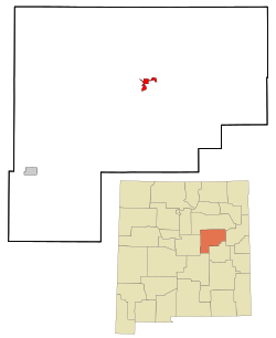
 Location of Santa Rosa, New Mexico | |
| Coordinates: 34°56′10″N 104°40′37″W / 34.93611°N 104.67694°W | |
| Country | United States |
| State | New Mexico |
| County | Guadalupe |
| Named for | Rose of Lima |
| Government | |
| • Mayor | Nelson Kotiar |
| Area | |
• Total | 5.02 sq mi (13.01 km2) |
| • Land | 5.00 sq mi (12.95 km2) |
| • Water | 0.03 sq mi (0.06 km2) |
| Elevation | 4,567 ft (1,392 m) |
| Population | |
• Total | 2,850 |
| • Density | 570.11/sq mi (220.13/km2) |
| Time zone | UTC-7 (Mountain (MST)) |
| • Summer (DST) | UTC-6 (MDT) |
| ZIP code | 88435 |
| Area code | 575 |
| FIPS code | 35-70670 |
| GNIS feature ID | 2411828[2] |
| Website | santarosanm |

Santa Rosa is a city in and the county seat of Guadalupe County, New Mexico, United States.[4] The population was 2,848 at the 2010 census.[5] It lies between Albuquerque and Tucumcari, situated on the Pecos River at the intersection of Interstate 40 and U.S. Route 54 and 84. The city is located on the western edge of the Llano Estacado or "staked plains" of eastern New Mexico and west Texas.
- ^ "ArcGIS REST Services Directory". United States Census Bureau. Retrieved October 12, 2022.
- ^ a b U.S. Geological Survey Geographic Names Information System: Santa Rosa, New Mexico
- ^ Cite error: The named reference
USCensusDecennial2020CenPopScriptOnlywas invoked but never defined (see the help page). - ^ "Find a County". National Association of Counties. Retrieved June 7, 2011.
- ^ "Geographic Identifiers: 2010 Demographic Profile Data (G001): Santa Rosa city, New Mexico". American Factfinder. U.S. Census Bureau. Retrieved December 23, 2016.[dead link]
