You can help expand this article with text translated from the corresponding article in Italian. (January 2022) Click [show] for important translation instructions.
|
Santarcangelo di Romagna | |
|---|---|
| Comune di Santarcangelo di Romagna | |
 | |
| Coordinates: 44°04′N 12°27′E / 44.067°N 12.450°E | |
| Country | Italy |
| Region | Emilia-Romagna |
| Province | Rimini |
| Frazioni | Canonica, La Giola, Montalbano, San Martino dei Mulini, San Michele, Sant'Ermete, San Vito |
| Government | |
| • Mayor | Alice Parma |
| Area | |
• Total | 45 km2 (17 sq mi) |
| Elevation | 42 m (138 ft) |
| Population (2009)[2] | |
• Total | 21,320 |
| • Density | 470/km2 (1,200/sq mi) |
| Demonym | Santarcangiolesi |
| Time zone | UTC+1 (CET) |
| • Summer (DST) | UTC+2 (CEST) |
| Postal code | 47822 |
| Dialing code | 0541 |
| Patron saint | St. Michael Archangel |
| Saint day | September 29 |
| Website | Official website |
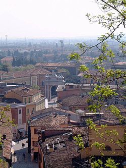
Santarcangelo di Romagna (Romagnol: Santarcànzul) is a comune in the province of Rimini, in the Italian region of Emilia-Romagna, on the Via Emilia. As of 2009, it had a population of some 21,300. It is crossed by two rivers, the Uso and the Marecchia.
The municipality includes much of the town of San Vito, notable for the Ponte di San Vito and the Sanctuary of Madonna di Casale.[3][4]
- ^ "Superficie di Comuni Province e Regioni italiane al 9 ottobre 2011". Italian National Institute of Statistics. Retrieved 16 March 2019.
- ^ "Popolazione Residente al 1° Gennaio 2018". Italian National Institute of Statistics. Retrieved 16 March 2019.
- ^ Cite error: The named reference
barbaresi233was invoked but never defined (see the help page). - ^ "29 aprile 1868 - Nasce a Trebbio di Poggio Berni il Beato Pio Campidelli" [29 April 1868 – Blessed Pio Campidelli was born in Trebbio di Poggio Berni]. Chiamami Città (in Italian). 28 April 2023. Retrieved 31 January 2024.


