| Santiam River | |
|---|---|
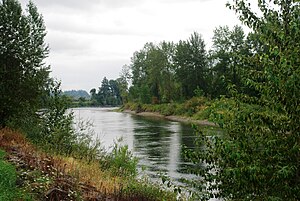
 Near Interstate 5 in Linn County | |
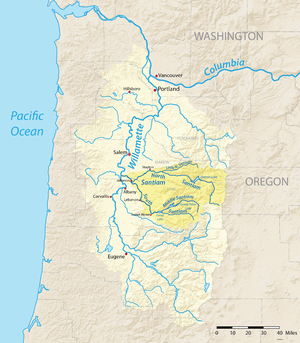
 Map of the Willamette River watershed with the Santiam River highlighted | |
| Etymology | Kalapuya tribe that lived near the river until removal to the Grande Ronde Reservation[2] |
| Location | |
| Country | United States |
| State | Oregon |
| County | Linn and Marion |
| Physical characteristics | |
| Source | confluence of North Santiam and South Santiam rivers |
| • location | Linn and Marion counties, Oregon |
| • coordinates | 44°41′21″N 123°00′27″W / 44.68917°N 123.00750°W[1] |
| • elevation | 222 ft (68 m)[3] |
| Mouth | Willamette River |
• location | between Albany and Salem, Marion County, Willamette Valley, Oregon |
• coordinates | 44°45′00″N 123°08′20″W / 44.75000°N 123.13889°W[1] |
• elevation | 164 ft (50 m)[1] |
| Length | 12 mi (19 km)[a] |
| Basin size | 1,830 sq mi (4,700 km2) |
| Discharge | |
| • location | Jefferson |
| • average | 7,714 cu ft/s (218.4 m3/s) |
| • minimum | 260 cu ft/s (7.4 m3/s) |
| • maximum | 202,000 cu ft/s (5,700 m3/s) |
The Santiam River /ˌsæntiːˈæm/ is a tributary of the Willamette River, about 12 miles (19 km) long, in western Oregon in the United States. Through its two principal tributaries, the North Santiam and the South Santiam rivers, it drains a large area of the Cascade Range at the eastern side of the Willamette Valley east of Salem and Corvallis.
- ^ a b c "Santiam River". Geographic Names Information System (GNIS). United States Geological Survey. November 28, 1980. Retrieved July 24, 2009.
- ^ McArthur, Lewis A.; McArthur, Lewis L. (2003). Oregon Geographic Names (7th ed.). Portland, OR: Oregon Historical Society Press. p. 848. ISBN 0-87595-277-1.
- ^ Google Earth elevation for GNIS coordinates
- ^ "Monmouth, Sydney, and Albany Oregon quadrants" (topographic map). United States Geological Survey. Retrieved July 24, 2009 – via TopoQuest.
Cite error: There are <ref group=lower-alpha> tags or {{efn}} templates on this page, but the references will not show without a {{reflist|group=lower-alpha}} template or {{notelist}} template (see the help page).
