Sar'a
صرعة Surah | |
|---|---|
 Neby Samit, picture taken between 1900 and 1920 | |
| Etymology: from Zoreah[1] | |
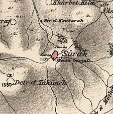
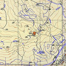
A series of historical maps of the area around Sar'a (click the buttons) | |
Location within Mandatory Palestine | |
| Coordinates: 31°46′31″N 34°59′6″E / 31.77528°N 34.98500°E | |
| Palestine grid | 148/131 |
| Geopolitical entity | Mandatory Palestine |
| Subdistrict | Jerusalem |
| Date of depopulation | July 18, 1948[2] |
| Area | |
| • Total | 4,967 dunams (4.967 km2 or 1.918 sq mi) |
| Population | |
| • Total | 340 |
| Cause(s) of depopulation | Military assault by Yishuv forces |
| Current Localities | Tarum[5] Zorah |
Sar'a (Arabic: صرعة), was a Palestinian Arab village located 25 km west of Jerusalem, depopulated in the 1948 war. The site lies on a hill, at an elevation of about 1,150 feet (350 m) above sea-level.[6]
- ^ Palmer, 1881, p. 329
- ^ Morris, 2004, xx, village#332. Also gives cause of depopulation].
- ^ Department of Statistics, 1945, p. 25
- ^ Government of Palestine, Department of Statistics. Village Statistics, April, 1945. Quoted in Hadawi, 1970, p. 58
- ^ Khalidi, 1992, p. 314
- ^ The Palestine Exploration Fund Quarterly Statement, London 1871, p. 93


