Saugerties South, New York | |
|---|---|
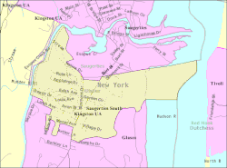
 U.S. Census reference map | |
 Location in Ulster County and the state of New York. | |
| Coordinates: 42°3′34″N 73°57′22″W / 42.05944°N 73.95611°W | |
| Country | United States |
| State | New York |
| County | Ulster |
| Area | |
| • Total | 1.29 sq mi (3.34 km2) |
| • Land | 1.07 sq mi (2.76 km2) |
| • Water | 0.22 sq mi (0.58 km2) |
| Population (2020) | |
| • Total | 2,442 |
| • Density | 2,290.81/sq mi (884.39/km2) |
| Time zone | UTC-5 (EST) |
| • Summer (DST) | UTC-4 (EDT) |
| FIPS code | 36-65310 |
Saugerties South is a hamlet (and census-designated place) in Ulster County, New York, United States. The population was 2,442 at the 2020 census.
Saugerties South is a community south of the Village of Saugerties and Esopus Creek in the Town of Saugerties. U.S. Route 9W passes through the community.
- ^ "ArcGIS REST Services Directory". United States Census Bureau. Retrieved September 20, 2022.