Scheut | |
|---|---|
Neighbourhood | |
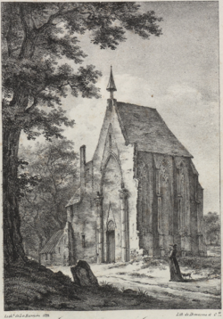
 Former chapel of Scheut (1823) | |
| Coordinates: 50°50′51″N 4°18′27″E / 50.84750°N 4.30750°E | |
| Country | Belgium |
| Region | Brussels-Capital Region |
| Municipality | Anderlecht |
| Time zone | UTC+1 (CET) |
| • Summer (DST) | UTC+2 (CEST) |
| Postal code | 1070 |
| Area codes | 02 |
Scheut (French: [skøt]; Dutch: [sxøːt] ) is a district of Anderlecht, a municipality of Brussels, Belgium. Located in the north of Anderlecht, it is bounded by the border with the municipality of Molenbeek-Saint-Jean to the north, the historical centre of Anderlecht to the south, the Birmingham district to the east, the Scheutveld district to the west and the semi-natural site of the Scheutbos to the north-west.
The district is crossed by the Chaussée de Ninove/Ninoofsesteenweg running east–west and is served by the metro stations Aumale, Jacques Brel, and Gare de l'Ouest/Weststation (Brussels-West Station).

