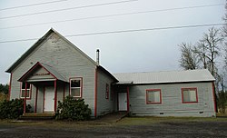
Scholls, Oregon | |
|---|---|
 Scholls Grange | |
| Coordinates: 45°24′29″N 122°55′20″W / 45.40806°N 122.92222°W | |
| Country | United States |
| State | Oregon |
| County | Washington |
| Elevation | 151 ft (46 m) |
| Time zone | UTC-8 (Pacific (PST)) |
| • Summer (DST) | UTC-7 (PDT) |
| ZIP code | 97140,97123 |
| Area code(s) | 503 and 971 |
| GNIS feature ID | 1158471[1] |
Scholls, Oregon is an unincorporated community in Washington County, Oregon, United States. It is located along the southern shore of the Tualatin River, near the intersection of Oregon Routes 210 and 219. Scholls is located approximately seven miles north of Newberg, seven miles west of Tigard and eight miles south of Hillsboro. The area around Scholls is primarily agricultural.

