| Schwaben Creek | |
|---|---|
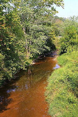
 Schwaben Creek looking upstream | |
Satellite map of Schwaben Creek. The red dot is the stream's source and blue dot is its mouth. | |
| Location | |
| Country | United States |
| State | Pennsylvania |
| County | Northumberland |
| Physical characteristics | |
| Source | |
| • location | Upper Mahanoy Township, Northumberland County, Pennsylvania |
| • coordinates | 40°43′04″N 76°36′48″W / 40.7179°N 76.6134°W |
| • elevation | 800 feet (240 m)[1] |
| Mouth | |
• location | Mahanoy Creek in Jackson Township, Northumberland County, Pennsylvania |
• coordinates | 40°43′06″N 76°47′36″W / 40.7183°N 76.7933°W |
• elevation | 480 feet (150 m)[2] |
| Length | 12.4 mi (20.0 km) |
| Basin size | 22.48 sq mi (58.2 km2) |
| Basin features | |
| Tributaries | |
| • left | Middle Creek, Mouse Creek |
Schwaben Creek is a tributary of Mahanoy Creek in Northumberland County, Pennsylvania, in the United States.[3] Schwaben Creek is approximately 12.4 miles (20.0 km) long.[4][2] The creek has two named tributaries, which both join Schwaben Creek fairly close to its mouth. The tributaries are called Middle Creek and Mouse Creek. Schwaben Creek flows through Upper Mahanoy Township, Washington Township, and Jackson Township. Nearly all of the creek's watershed is devoted to agricultural land and forests, although there is some development. Painted furniture was also made in the Schwaben Creek valley in the 18th and 19th centuries. The creek is in the ridge-and-valley geographical province.
- ^ Google Maps, 2013, retrieved November 14, 2013
- ^ a b Google Maps, 2013, retrieved November 9, 2013
- ^ Jon M. Capacasa (August 30, 2012), Decision Rationale Total Maximum Daily Load of Sediment Schwaben Creek Watershed Northumberland County, Pennsylvania (PDF), retrieved November 9, 2013
- ^ U.S. Geological Survey. National Hydrography Dataset high-resolution flowline data. The National Map, accessed July 8th, 2020