| Schwarza | |
|---|---|
 The Schwarza in the Höllental | |
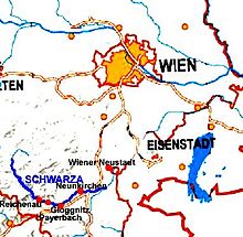
 Map of the Schwarza in southern Lower Austria | |
| Location | |
| Country | Austria |
| State | Lower Austria |
| Region | Industrieviertel |
| Physical characteristics | |
| Source | |
| • location | Gutenstein Alps |
| • coordinates | 47°52′17″N 15°37′23″E / 47.8714°N 15.6231°E |
| • elevation | 833 m (AA) |
| Mouth | |
• location | Discharges jointly with the River Pitten into the Leitha at Haderswörth |
• coordinates | 47°44′6.56″N 16°13′28.72″E / 47.7351556°N 16.2246444°E |
• elevation | 302 m (AA) |
| Length | 47.7 km (29.6 mi) [1] |
| Basin features | |
| Progression | Leitha→ Danube→ Black Sea |
| Landmarks |
|
The Schwarza is a river in Lower Austria. It is the left headstream of the Leitha.
- ^ Niederösterreich Atlas (Lower Austria)