| Schweizerland | |
|---|---|
| Schweizerland Alps | |
 View of the mountains rising above the Midgard Glacier at the southern end of the range. | |
| Highest point | |
| Peak | Mont Forel |
| Elevation | 3,383 m (11,099 ft) |
| Dimensions | |
| Length | 75 km (47 mi) N/S |
| Width | 40 km (25 mi) E/W |
| Area | 270 km2 (100 sq mi) |
| Geography | |
| Country | Greenland |
| Range coordinates | 66°40′N 37°0′W / 66.667°N 37.000°W |
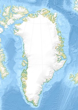
Schweizerland, also known as Schweizerland Alps,[1] is a mountain range in King Christian IX Land, eastern Greenland. Administratively this range is part of the Sermersooq Municipality.[2] Its highest point is one of the highest peaks in Greenland.
Owing to its high peaks Schweizerland is a popular climbing destination, together with the Watkins Range to the northeast and the Stauning Alps further north.[3] Tasiilaq Heliport is located near the area of the range.
- ^ "Mont Forel 3360m". Greenland Independent. Retrieved 27 June 2016.
- ^ Google Earth
- ^ "Climbing and Mountaineering in Greenland". Lonely Planet. Retrieved 18 June 2016.
