Sedgwick County | |
|---|---|
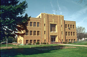
 Sedgwick County Courthouse, Julesburg | |
 Location within the U.S. state of Colorado | |
 Colorado's location within the U.S. | |
| Coordinates: 40°53′N 102°21′W / 40.88°N 102.35°W | |
| Country | |
| State | |
| Founded | April 9, 1889 |
| Named for | John Sedgwick |
| Seat | Julesburg |
| Largest town | Julesburg |
| Area | |
• Total | 549 sq mi (1,420 km2) |
| • Land | 548 sq mi (1,420 km2) |
| • Water | 1.4 sq mi (4 km2) 0.2% |
| Population (2020) | |
• Total | 2,404 |
• Estimate (2023) | 2,299 |
| • Density | 4.4/sq mi (1.7/km2) |
| Time zone | UTC−7 (Mountain) |
| • Summer (DST) | UTC−6 (MDT) |
| Congressional district | 4th |
| Website | sedgwickcounty |
Sedgwick County is a county located in the U.S. state of Colorado. As of the 2020 census, the population was 2,404.[1] The county seat is Julesburg.[2] The county was named for Fort Sedgwick, a military post along the Platte Trail, which was named for General John Sedgwick. It is located at the state border with Nebraska.
- ^ "State & County QuickFacts". United States Census Bureau. Retrieved September 5, 2021.
- ^ "Find a County". National Association of Counties. Retrieved June 7, 2011.