This article needs additional citations for verification. (July 2023) |
Selaphum
เสลภูมิ | |
|---|---|
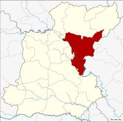
 District location in Roi Et province | |
| Coordinates: 16°2′0″N 103°56′2″E / 16.03333°N 103.93389°E | |
| Country | Thailand |
| Province | Roi Et |
| Area | |
| • Total | 792.338 km2 (305.923 sq mi) |
| Population (2005) | |
| • Total | 122,100 |
| • Density | 154.1/km2 (399/sq mi) |
| Time zone | UTC+7 (ICT) |
| Postal code | 45120 |
| Geocode | 4510 |
Selaphum (Thai: เสลภูมิ, pronounced [sěː.lā.pʰūːm]) is a district (amphoe) in the eastern part of Roi Et province, northeastern Thailand.