Selma, Texas | |
|---|---|
 Selma City Hall, February 2014 | |
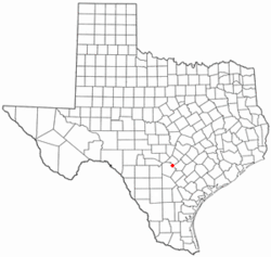
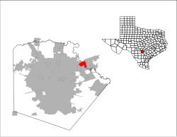
 Location of Selma, Texas | |
 | |
| Coordinates: 29°35′12″N 98°18′48″W / 29.58667°N 98.31333°W | |
| Country | United States |
| State | Texas |
| Counties | Bexar, Guadalupe, and Comal |
| Incorporated | 1964 |
| Area | |
| • Total | 5.04 sq mi (13.06 km2) |
| • Land | 5.04 sq mi (13.04 km2) |
| • Water | 0.00 sq mi (0.01 km2) |
| Elevation | 758 ft (231 m) |
| Population (2020) | |
| • Total | 10,952 |
| • Density | 2,210.48/sq mi (853.40/km2) |
| Time zone | UTC-6 (Central (CST)) |
| • Summer (DST) | UTC-5 (CDT) |
| ZIP code | 78154 |
| Area code(s) | 210, 726 (planned) |
| FIPS code | 48-66704[3] |
| GNIS feature ID | 2411864[2] |
| Website | ci |
Selma is a city in Bexar, Comal,[4] and Guadalupe counties in Texas, United States. It is part of the San Antonio metropolitan statistical area. Its population was 10,952 at the 2020 census,[5] up from 5,540 at the 2010 census.[6] Selma was settled by German and Polish immigrants in the mid-1800s.[7]
The Retama Park horse-racing track is located in Selma.[8]
- ^ "2019 U.S. Gazetteer Files". United States Census Bureau. Retrieved August 7, 2020.
- ^ a b U.S. Geological Survey Geographic Names Information System: Selma, Texas
- ^ "U.S. Census website". United States Census Bureau. Retrieved January 31, 2008.
- ^ "Subcounty population estimates: Texas 2000-2006". United States Census Bureau, Population Division. June 28, 2007. Archived from the original (CSV) on November 26, 2007. Retrieved January 9, 2008.
- ^ "Geographic Identifiers: 2010 Demographic Profile Data (G001): Selma city, Texas". U.S. Census Bureau, American Factfinder. Archived from the original on February 12, 2020. Retrieved April 14, 2014.
- ^ "Population and Housing Unit Estimates". Retrieved September 14, 2019.
- ^ "History of Selma | Selma, TX - Official Website".
- ^ Retama Park