Sembawang | |
|---|---|
| Other transcription(s) | |
| • Malay | Sembawang (Rumi) سمباوڠ (Jawi) |
| • Chinese | 三巴旺 Sānbāwàng (Pinyin) Sam-pa-ōng (Hokkien POJ) |
| • Tamil | செம்பவாங் Cempavāṅ (Transliteration) |
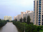
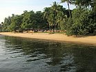
From top left to right: HDB flats along Sungei Sembawang, Senoko Power Station, Sembawang Shipyard, MRT viaduct in Sembawang, Wak Hassan Beach | |
 Location of Sembawang in Singapore | |
| Coordinates: 1°26′56.8″N 103°49′6.58″E / 1.449111°N 103.8184944°E | |
| Country | |
| Region | North Region
|
| CDC | |
| Town council |
|
| Constituency | |
| Government | |
| • Mayor | North West CDC
|
| • Members of Parliament | Sembawang GRC |
| Area | |
• Total | 12.34 km2 (4.76 sq mi) |
| • Residential | 3.31 km2 (1.28 sq mi) |
| Population | |
• Total | 95,920 |
| • Density | 7,800/km2 (20,000/sq mi) |
| Dwelling units | 20,311 |
| Projected ultimate | 65,000 |
Sembawang is a planning area and residential town located in the North Region of Singapore. Sembawang planning area is bordered by Simpang to the east, Mandai to the south, Yishun to the southeast, Woodlands to the west and the Straits of Johor to the north.
Despite the relatively large development in the Sembawang New Town, the area remains largely suburban, with military, industrial and recreational facilities at its periphery. It hosted a major naval base and port facilities since the early 20th century, and continues to handle regular shipping traffic today along its wharves.
- ^ a b "Singapore: Subdivision (Planning Areas and Subzones) - Population Statistics, Charts and Map". www.citypopulation.de.
- ^ a b HDB Key Statistics FY 2014/2015 Archived 4 March 2016 at the Wayback Machine
- ^ "Statistics Singapore - Geographic Distribution - 2018 Latest Data". Retrieved 11 February 2019.


