Senneterre | |
|---|---|
 | |
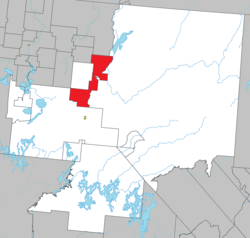
 Location within La Vallée-de-l'Or RCM | |
| Coordinates: 48°23′N 77°15′W / 48.383°N 77.250°W[1] | |
| Country | Canada |
| Province | Quebec |
| Region | Abitibi-Témiscamingue |
| RCM | La Vallée-de-l'Or |
| Settled | 1910s |
| Constituted | March 23, 1923 |
| Government | |
| • Mayor | Jacline Rouleau |
| • Federal riding | Abitibi—Baie-James— Nunavik—Eeyou |
| • Prov. riding | Abitibi-Est |
| Area | |
| • Total | 630.08 km2 (243.28 sq mi) |
| • Land | 567.05 km2 (218.94 sq mi) |
| Elevation | 301 m (988 ft) |
| Population (2021)[3] | |
| • Total | 1,202 |
| • Density | 2.1/km2 (5/sq mi) |
| • Pop (2016-21) | |
| • Dwellings | 606 |
| Time zone | UTC−5 (EST) |
| • Summer (DST) | UTC−4 (EDT) |
| Postal code(s) | |
| Area code | 819 |
| Highways | |
| Website | www |
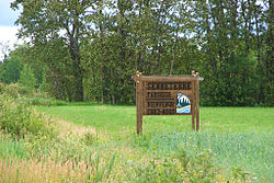
Senneterre is a parish municipality in northwestern Quebec, Canada, in the La Vallée-de-l'Or Regional County Municipality. The parish is mostly a rural municipality that almost completely surrounds the actual population centre of the neighbouring City of Senneterre.
The place is named after the geographic township of Senneterre, that in turn was named in honour of a captain of the Languedoc Regiment that fought under General Montcalm.[1]
- ^ a b "Senneterre (Municipalité de paroisse)" (in French). Commission de toponymie du Québec. Retrieved 2011-01-13.
- ^ a b "Répertoire des municipalités: Geographic code 89045". www.mamh.gouv.qc.ca (in French). Ministère des Affaires municipales et de l'Habitation.
- ^ a b "Senneterre, Quebec (parish) (Code 2489045) Census Profile". 2021 census. Government of Canada - Statistics Canada.
