| Sespe Wilderness | |
|---|---|
 | |
| Location | California, United States |
| Nearest city | Ventura, California |
| Coordinates | 34°35′06″N 119°01′12″W / 34.585°N 119.02°W[1] |
| Area | 219,700 acres (88,900 ha) |
| Established | 1992 |
| Governing body | U.S. Forest Service |
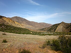
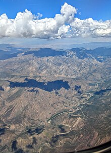
The Sespe Wilderness is a 219,700-acre (88,900 ha) wilderness area in the eastern Topatopa Mountains and southern Sierra Pelona Mountains, within the Los Padres National Forest (LPNF), in Ventura County, Southern California. The wilderness area is primarily located within the Ojai and Mt. Pinos ranger districts of the LPNF.
The wilderness was created by the U.S. Congress as part of the Los Padres Condor Range and River Protection Act of 1992 (Public Law 102-301). The same legislation also established the Chumash, Garcia, Machesna Mountain, Matilija, and Silver Peak Wilderness areas.[2][3] The Sespe Condor Sanctuary is within the Sespe Wilderness. It was established to promote the propagation and growth of the California condor, and is closed to the public.[4][5]

- ^ "Sespe Wilderness". Geographic Names Information System. United States Geological Survey, United States Department of the Interior. Retrieved August 27, 2015.
- ^ "George Bush: Statement on Signing the Los Padres Condor Range and River Protection Act". The American Presidency Project. Retrieved 20 January 2018.
- ^ Los Padres Condor Range and River Protection Act (PDF). June 19, 1992. Retrieved January 19, 2018.
- ^ "Sespe Wilderness". Wilderness.net. Retrieved August 27, 2015.
- ^ "Sespe Wilderness". U.S. Forest Service. Retrieved August 27, 2015.

