This article contains too many or overly lengthy quotations. (September 2024) |
| UNESCO World Heritage Site | |
|---|---|
 Ruins of Shangdu | |
| Location | Shangdu Town, Zhenglan Banner, Inner Mongolia, China |
| Criteria | Cultural: ii, iii, iv, vi |
| Reference | 1389 |
| Inscription | 2012 (36th Session) |
| Area | 25,131.27 ha |
| Buffer zone | 150,721.96 ha |
| Coordinates | 42°21′35″N 116°10′45″E / 42.35972°N 116.17917°E |
| Shangdu | |||||||||||
|---|---|---|---|---|---|---|---|---|---|---|---|
| Chinese | 上都 | ||||||||||
| Hanyu Pinyin | Shàngdū | ||||||||||
| Literal meaning | Upper Capital | ||||||||||
| |||||||||||


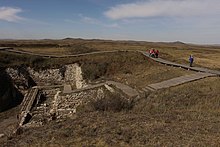
Shangdu (Chinese: 上都; pinyin: Shàngdū; pronounced [ʂâŋtú]; lit. 'Upper Capital'; Mongolian: ᠱᠠᠩᠳᠤ, Mongolian Cyrillic: Шанду, romanized: Šandu), more popularly known as Xanadu (/ˈzænəduː/ ZAN-ə-doo), was the summer capital[1][2] of the Yuan dynasty of China before Kublai moved his throne to the former Jin dynasty capital of Zhōngdū (Chinese: 中都; lit. 'Middle Capital') which was renamed Khanbaliq (present-day Beijing). Shangdu is located in the present-day Zhenglan Banner, Inner Mongolia. In June 2012, it was made a World Heritage Site for its historical importance and for the unique blending of Mongolian and Chinese culture.[3]
Venetian traveller Marco Polo described Shangdu to Europeans after visiting it in 1275. It was conquered in 1369 by the Ming army under Chang Yuchun. Historical accounts of the city inspired the famous poem Kubla Khan, written by English Romantic poet Samuel Taylor Coleridge in 1797.
- ^ Tomoko, Masuya (2013). "Seasonal capitals with permanent buildings in the Mongol empire". In Durand-Guédy, David (ed.). Turko-Mongol Rulers, Cities and City Life. Leiden: Brill. p. 239.
- ^ Atwood, Christopher P. (2004). Encyclopedia of Mongolia and the Mongol Empire. Facts on File. p. 605.
- ^ "Xanadu (China), Bassari Country (Senegal) and Grand Bassam (Côte d'Ivoire) added to UNESCO's World Heritage List". Archived from the original on April 15, 2016.

