This article needs additional citations for verification. (November 2018) |
Shankarapura
Pangla | |
|---|---|
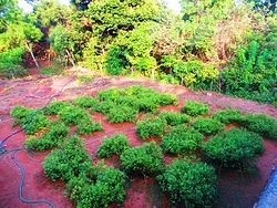
 Jasmine Garden | |
| Coordinates: 13°15′36″N 74°46′12″E / 13.26000°N 74.77000°E | |
| Country | |
| State | Karnataka |
| District | Udupi |
| Government | |
| • Body | Grama panchayath |
| Time zone | UTC+5:30 (IST) |
| PIN | 574115 |
| Nearest city | Udupi |
| Lok Sabha constituency | Udupi-Chikmagalur |
| Civic agency | Grama panchayath |
Shankarapura a tiny hamlet in Udupi taluk, Karnataka state, India. Situated 3 km east of NH 17 (now NH 66). Shankerpura lies between the towns of Katapadi and Shirva. It can be reached via Katpadi-Shirva road on NH 66 at Katapadi from west and Karkala / Belmann / Shirva road from the east. It is about 10 km to the south of temple town Udupi, and 52 km north of the major port city of Mangalore.
People of this region speak Tulu, Kannada, Konkani, Byari, English and Hindi languages

