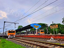
Santipur | |
|---|---|
City | |
 | |
| Coordinates: 23°15′N 88°26′E / 23.25°N 88.43°E | |
| Country | |
| State | West Bengal |
| District | Nadia |
| Established | 1853 |
| Government | |
| • Type | Municipality |
| • Body | Santipur Municipality |
| • Chairperson | Subrata Ghosh |
| Area | |
• City | 25.88 km2 (9.99 sq mi) |
| • Rank | 1st in Nadia District |
| Elevation | 15 m (49 ft) |
| Population (2011)[1] | |
• City | 151,774 |
| • Rank | 2nd in Nadia District |
| • Density | 5,900/km2 (15,000/sq mi) |
| • Metro | 288,718 |
| Languages | |
| • Official | Bengali, English |
| Time zone | UTC+5:30 (IST) |
| PIN | 741404 |
| Telephone code | 03472 |
| Lok Sabha constituency | Ranaghat |
| Member of Parliament | Jaganath Sarkar |
| Vidhan Sabha constituency | 86-Santipur |
| Member of Legislative Assembly | Braja Kishore Goswami |
Santipur is a city and a municipality in the Ranaghat subdivision of Nadia district in the Indian state of West Bengal. The fort area of this city, also known as Daak-Garh (calling or gathering room) is thought to have been built by Raja Krishnachandra of Nadia.
- ^ a b "Santipur City".

