| Sheen | |
|---|---|
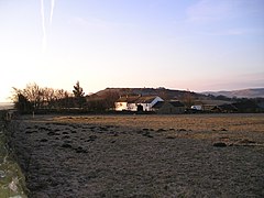
 Looking south towards Top Farm, with Sheen Hill beyond | |
Location within Staffordshire | |
| Population | 234 (2011 census) |
| OS grid reference | SK 114 615 |
| Civil parish |
|
| District | |
| Shire county | |
| Region | |
| Country | England |
| Sovereign state | United Kingdom |
| Post town | Buxton |
| Postcode district | SK17 |
| Police | Staffordshire |
| Fire | Staffordshire |
| Ambulance | West Midlands |
| UK Parliament | |
Sheen is a village and civil parish in the Staffordshire Moorlands district, in north-east Staffordshire, England. In 2011 the parish had a population of 234.
The parish is about 3.5 miles (5.6 km) north to south and about 2 miles (3.2 km) east to west. The eastern boundary is the River Dove (the boundary with Derbyshire), and the western boundary is the River Manifold.[1]
There is a north-west to south-east ridge forming Sheen Moor; the village of Sheen, on a road running north–south through the parish, is near the southern end of the ridge. The highest point, at 380 metres (1,250 ft), is Sheen Hill. Hulme End, near the southern boundary, has height 271 metres (889 ft); Knowsley, near the northern boundary, has height 340 metres (1,120 ft). There is a steep escarpment to the River Dove in the east, and the ground falls less steeply to the River Manifold in the west. There is scattered settlement throughout the parish.[1]
The parish was described in 1851: "The face of the country is here wild and romantic, but the soil about the village is fertile and well enclosed."[2]
