| Sheerwater | |
|---|---|
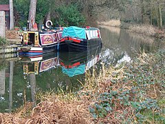
 Boats on the Basingstoke Canal | |
 A small part of Albert Drive with high pines, long-established in the soil type, see Bagshot Formation. | |
Location within Surrey | |
| Population | 3,603 [1] |
| OS grid reference | TQ0260 |
| District | |
| Shire county | |
| Region | |
| Country | England |
| Sovereign state | United Kingdom |
| Post town | Woking |
| Postcode district | GU21 |
| Dialling code | 01932 |
| Police | Surrey |
| Fire | Surrey |
| Ambulance | South East Coast |
| UK Parliament | |
Sheerwater is a residential neighbourhood or small suburb of Woking, in the Woking district in Surrey, England, occasionally described as a village, between West Byfleet and Horsell.[2] Its border is defined to the north by a gently winding part of the Basingstoke Canal and to the south by the South West Main Line which passes from cutting level to that of an embankment. The neighbourhood has a business park and light industry at its south-western end. The whole area is linear, includes diverse green spaces to north and south, and covers 92 hectares (230 acres).
- ^ Key Statistics; Quick Statistics: Population Density United Kingdom Census 2011 Office for National Statistics Retrieved 17 November 2013
- ^ "Neighbourhoods map" (PDF). Archived from the original (PDF) on 7 January 2011. Retrieved 18 November 2012.
