Shelby, Alabama | |
|---|---|
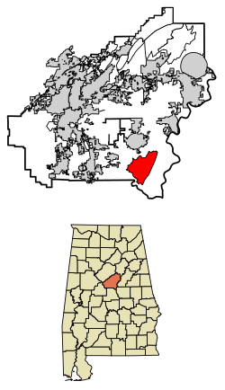
 Location of Shelby in Shelby County, Alabama. | |
| Coordinates: 33°06′37″N 86°35′03″W / 33.11028°N 86.58417°W | |
| Country | United States |
| State | Alabama |
| County | Shelby |
| Area | |
| • Total | 19.01 sq mi (49.24 km2) |
| • Land | 18.76 sq mi (48.59 km2) |
| • Water | 0.25 sq mi (0.66 km2) |
| Elevation | 495 ft (151 m) |
| Population (2020) | |
| • Total | 940 |
| • Density | 50.11/sq mi (19.35/km2) |
| Time zone | UTC-6 (Central (CST)) |
| • Summer (DST) | UTC-5 (CDT) |
| Area code(s) | 205, 659 |
| GNIS feature ID | 126669[2] |
Shelby is a census-designated place and unincorporated community in Shelby County, Alabama, United States. Its population was 1,044 as of the 2010 census. The area is near Lay Lake and Waxahatchee Creek. Shelby Iron Park is located at the heart of the area.[3] Two sites in Shelby, The Brick House and the Old Shelby Hotel, are listed on the Alabama Register of Landmarks and Heritage.[4]
- ^ "2020 U.S. Gazetteer Files". United States Census Bureau. Retrieved October 29, 2021.
- ^ "Shelby". Geographic Names Information System. United States Geological Survey, United States Department of the Interior.
- ^ "U.S. Census website". United States Census Bureau. Retrieved May 14, 2011.
- ^ "Properties on the Alabama Register of Landmarks & Heritage". Alabama Historical Commission. www.preserveala.org. Archived from the original on September 4, 2012. Retrieved June 5, 2014.
