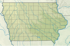
| Shell Rock River Shellrock River | |
|---|---|
| Location | |
| Country | United States |
| States | Minnesota, Iowa |
| Counties (Minnesota) | Freeborn |
| Counties (Iowa) | Worth, Cerro Gordo, Floyd, Butler, Bremer, Black Hawk |
| Physical characteristics | |
| Source | Albert Lea Lake |
| • location | Freeborn County, Minnesota |
| • coordinates | 43°36′42″N 93°17′37″W / 43.6116242°N 93.2935403°W[1] |
| Mouth | West Fork Cedar River |
• location | Black Hawk County, Iowa |
• coordinates | 42°38′03″N 92°30′05″W / 42.6341488°N 92.5012982°W |
• elevation | 869 ft (265 m)[1] |
| Length | 113 miles (182 km) |
| Discharge | |
| • location | Shell Rock, Iowa |
| • average | 1,211 cu/ft. per sec.[2] |
| Basin features | |
| Tributaries | |
| • right | Winnebago River |
The Shell Rock River is a 113-mile-long (182 km)[3] tributary of the West Fork Cedar River in southern Minnesota and northern Iowa in the United States. Via the Cedar and Iowa rivers, it is part of the Mississippi River watershed.[1]
- ^ a b c Cite error: The named reference
GNISwas invoked but never defined (see the help page). - ^ "Shell Rock River". USGS.
- ^ U.S. Geological Survey. National Hydrography Dataset high-resolution flowline data. The National Map, accessed May 13, 2011
